

Cet article est également disponible en: French
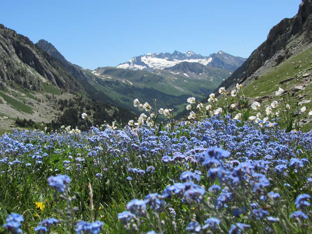
GR11: flowering pastures above Estos; in the background the Maladeta massifmassif de la Maladeta
I’ve now walked the Pyrenees from the Atlantic to the Mediterranean twice. First on the north side, then on the south. Having written about the first trek (If You Only Walk Long Enough: Exploring the Pyrenees), I’m trying to put my thoughts together for my book on the southern option, the GR 11. [Update 2016. Book now published as Footprints on the Mountains: The News from the Pyrenees]
So what are the differences for a walker between the GR10 and the GR11?
A comparison of the Pyrenean Way (GR 10) and the Senda Pirenaica (GR 11)

Routes of the GR 10 (red) and GR 11 (blue) compared. The loop halfway along the GR11 is where I had to divert to avoid snow between Góriz and Pineta
As I did them, the French GR 10 worked out at about 900km with 48,000m ascent and the GR 11 960km but with only 42,500m ascent. This might give the impression that the Spanish GR 11 is the soft option, but that’s not my impression.

Profile of the GR 10 (red) and GR 11 (blue). The 2734m peak on the GR 10 is the Hourquette d’Ossoue (GR 10 variant). Otherwise the GR 10 in general stays below the level of the GR 11
In fact the GR 11 spends much more time higher up, with a dozen passes above 2500m. The French trail tops out at 2509m: if you want to go higher you will have to take the diversions which pass over the Hourquette d’Ossoue (2734m) and Canigou (2786m) (both recommended). The difference in height means that there is more rock and less grass on the GR 11.
As for weather, there is a clear contrast between the wet, cold Basque country in the west and the dry, hot Mediterranean coast in the east. On the other hand the differences between the north side of the Pyrenees and the south are less marked, insignificant in the Basque country. In the central section, the relative height of the GR11 compared with its French counterpart means that it is cooler than might be anticipated.* Although you can expect to avoid snow after 14 June on the GR 10 you will need to wait until 7 July for the higher sections of the GR 11 to melt. In 2013, unable to delay my late June start, I had to take crampons.

GR 11: 25 June 2013 on one of the flatter sections between Respomuso and Baños de Panticosa
On both sides of the watershed the thunderstorms start at 16h00 so I planned to arrive before then.

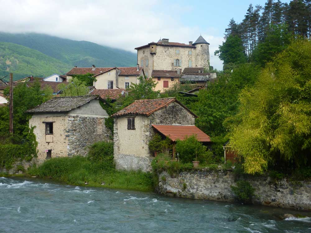
GR 11: Bestué after the storm
In terms of company, there are more refuges on the GR 10 and more walkers, which makes it more sociable. I kept arriving at refuges to be greeted by walkers I had seen on previous days. Sometimes we were walking in parallel for over a week.

GR 11: cooking in the Illa hut
Another factor to take into account is the maturity of the paths. The GR 10 was traced out in the 1960s and 1970s while the GR 11 is some 20 years younger. This means that GR 10 has, as well as more refuges, better waymarking, and a more gentle profile – sometimes I had the impression on the GR 11 that the planners had drawn a straight line on the map and followed it up the hill.
As the profiles show, both paths start out similarly in the Basque country, before the GR 11 begins take on height after 250km or so. At the Mediterranean end, the GR 11 descends earlier, while the GR 10 keeps relatively high until just before plunging into the sea.
Visually, both paths are spectacular and varied. The luxuriant Basque fields shade literally into the woods of Iraty.

GR 11: Basque pastures
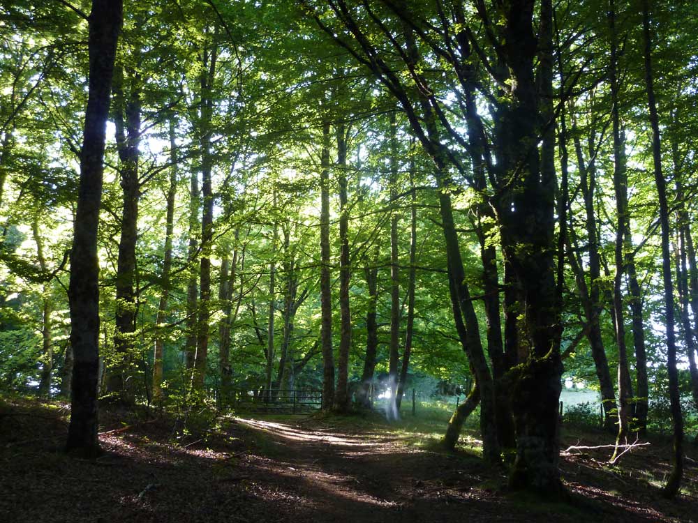
GR 11: forest between Burguete/Auritz and Hiriberri
Then come the high mountains, intersected by deep valleys sometimes glacial in origin, like the Cirque de Gavarnie and its Spanish counterpart, the Ordesa canyon.

Añisclo canyon

GR10: sheep in the Ariège
GR 10: Seix in the Ariège

GR 10: cork oaks near La Jonquera
Whatever the path, before reaching the Mediterranean you will pass through straggly cork oak forests followed by regimented vineyards. Either way there is sustenance at the end of the trail – the town of Banyuls on the GR 10 and a bar-restaurant at the Cap de Creus on the GR 11.
Ken Applegate from Hike Pyrenees has recently written a concise guide to walking the Spanish GR11.
*For every 100m of ascent, temperature descends 0.65 degrees C, on average.


Hi
Is it possible to get liquid fuel anywhere near the start of the GR11 and on a Saturday?
Hi Daniel
Irun is a city. It has shopping centres on the west side which you will pass near by, and a Decathalon in the centre of town so I would think you should be able to get all you need. What kind of fuel exactly?
Steve
Is either full route walkable beginning very early October? I’d much rather do either of these routes as opposed to the French Way on the Camino de Santiago.
Hi Frank
One of the problems with a late start is that many of the hostels will be closed. Unless you are super fit the walks end-to-end will take two months, including a few days rest. However you can have snow from the start of November. You may or may not be able to get through, but plan for diversions.
Good Luck, Steve
Thanks for the feedback…Very much appreciated, Steve!
Hi Steve,
I’m going to do either either the GR10 or GR11 this summer – but I can’t decide which one to do. Which one (if you had to choose) would you do and why?
I love your website by the way and it has been very helpful to me in the past so thanks for that too.
Thanks,
Josh
Hi Josh
You can also look at my more recent article comparing hiking the HRP, GR10 and GR11. Rather than me telling you what I would like, perhaps it would be more appropriate if you told me what you like to do and your experience of mountain walking, time available etc. and I will tell you which route is the best fit for you. (I am going to be away for three days so won’t be able to reply quickly).
Steve
Steve,
Superb website. Looking at the above, informed replies depend upon my informing as well… I am also unsure about GR10 or GR11, and particularly east-west or west-east. Experienced hiker for short distances, probably a little time-restricted, definitely going to be wild camping, and very much after as much solitude as possible. Can only complete before August 1 (I coach rugby, so the job starts again then). I know there are plenty of refill spots for provisions along GR10, but also in GR11? Does this also apply to camping supplies? And most people go west-east… is east west better for solitude? Many thanks for any replies, Danny
Hi Danny
On the GR10 most people walk W-E, on the GR11 it is more balanced I think, but still mostly W-E. However the GR11 is less frequented. If you want solitude, you will have it anyway until 1 July because of excessive snow, whichever way you walk. This is probably the most important factor, so I recommend starting on the Atlantic because you will have more snow-free days. Also you won’t meet crowds on the GR11 except near certain refuges. Note that wild camping is not allowed in the Monte Perdido National Park except near Goriz and ?Escuian. Nor is it allowed in the Aigüestortes i Estany de Sant Maurici National Park.
Since you are inexperienced at long-distance you need to take into account how much energy levels diminish after 3-4 days. Normally 6-8 hours walking is to be recommended as there is a lot of climbing. Do more than that and you risk chronic fatigue after three weeks.
There are fewer refill spots on the GR11, which is generally wilder than the GR10. Camping supplies are difficult to get. I prefer solid fuel briquettes to gas partly for this reason.
Let me know if I haven’t covered all the points. And periodic snow reports would be helpful.
Steve
I walked a few days of the GR11 last August 2018. I flew from the UK to Biarritz and then caught the train to Hendaye, easy to find a camp site.The next day I walked over a bridge into Irun. I eventually found the route just befor the motorway.
https://travesiapirenaica.com/en/gr11/gr11.php – a very useful site to view and help you plan, in English as well.
I was surprised that I could not find a campsite in bera, Elizondo or at the Urkiaga Pass, (I wild camped) the first site was at Burguete/Auritz and that was 2km from the village.
I then turned back to France and St. Jean Pied du Port on the GR65 (The Camino)and was so surprised to find out that I was the only person (I think) who was going my way,so many people were walking towards Spain, I lost count in the end.
When I arrived in St Jean I then walked back to Hendaye via the GR10. I thought it was a really great 14 days.
Reg
Hi Steve – I am looking at taking some friends and doing a part of the GR10 or GR 11 next summer, late June into early July. Based on the time of year and the timeframe – about 7-9 days of hiking, is there a section of either you would recommend? We would prefer to stay in hotels or huts with private rooms. We have done most of the AV1 in Italy, hut to huts in the Julian Alps, and completed the TMB last summer…we are excited to do some hiking in the Pyrenees – can you recommend a section or two that you think are standouts?
Hello Margot
I’m sorry but if you really want to stay in hotels or huts with private rooms your choices will be extremely limited – essentially you can walk inland from the Atlantic coast on either the GR10 or GR11. Perhaps you would be better off staying in a hotel in a town (Cauterets, Bagnères-de-Luchon) and doing day walks from there. I hope this helps.
best wishes
On the other hand, if you can manage without the luxury of a hotel you could consider Etsaut – Gabas – Gourette – Arrens-Marsous – Ilhéou – Cauterets – Oulettes de Gaube – Gavarnie – Luz-St-Sauver…
Thanks for Great info!
I read that wild camping is restricted in many areas. What are the options? Hotels, B&B? I also understand there are villages along gr10. How frequent- in terms of supplying and lodging? Water supplies?
What books do you recommend?
I assume topographic maps are a must. Are there also apps offline?
Many thanks for any replies!
All best wishes,
Charlotte
Hi Charlotte
You should start with the Cicerone guide to the GR10. Once you have read that feel free to come back and ask any outstanding questions.
Happy planning
Steve
Hey Steve,
Thanks for the appreciated information.
We’d like to walk on the GR10 or GR11 for roughly a week and plan to wild camp. Would you recommend the stages you listed above (Etsaut – Gabas – Gourette – Arrens-Marsous – Ilhéou – Cauterets – Oulettes de Gaube – Gavarnie – Luz-St-Sauver)?
Cheers!
Benjamin
Hi Benjamin
The problem is that wild camping would be difficult near Cauterets and Gavarnie and Luz. I think you would be better off looking at Ariège. Good luck.
Steve
[…] main points Walking the Pyrenees , with a weblogfrom Steve Cracknell, who walked each routes; Cicerone […]
[…] details Walking the Pyrenees , with a blogfrom Steve Cracknell, who walked both routes; Cicerone guideOccasionally you go […]
I’m starting the GR10 from Banyuls Sur Mere on June 14th 2022. I’ve found the site http://www.GR10.org to be very useful for accomadation, etc.
Thanks for pointing that out Reg. There are also lots of resources on Facebook such as “Backpacking in the Pyrenees including GR10, GR11 and HRP”, “Refuges et Cabanes des Pyrénées”, “Long Distance Hiking in Europe”…
[…] details Walking the Pyrenees , with a blogfrom Steve Cracknell, who walked both routes; Cicerone […]