

Cet article est également disponible en: French
Pic de Crabère is steep but not dangerous. Just off the Pyrenean Way (GR10), it can be reached in a day, but most walkers stay in the Araing hostel overnight and tackle the final 700m of climbing in the cool of the next morning.
Day one: accidents will happen
Thankfully, serious accidents don’t happen often.
We set out from Eylie at 1000m above sea-level, climbing steadily, glad to be in the shade of the forest. But soon the sun is obliterated by cloud and at the Col des Cos the path dissolves into the mist. Parting undergrowth, scrambling over rocks, we follow the intermittent traces as best we can.

So it is a surprise to discover what looks like a speed camera attached to a silver birch. On the top I read: “Suivi faune sauvage – ONCFS (wild animal tracking – Forestry commission)”. This is bear country. I look around for scratches on nearby trees. Nothing.
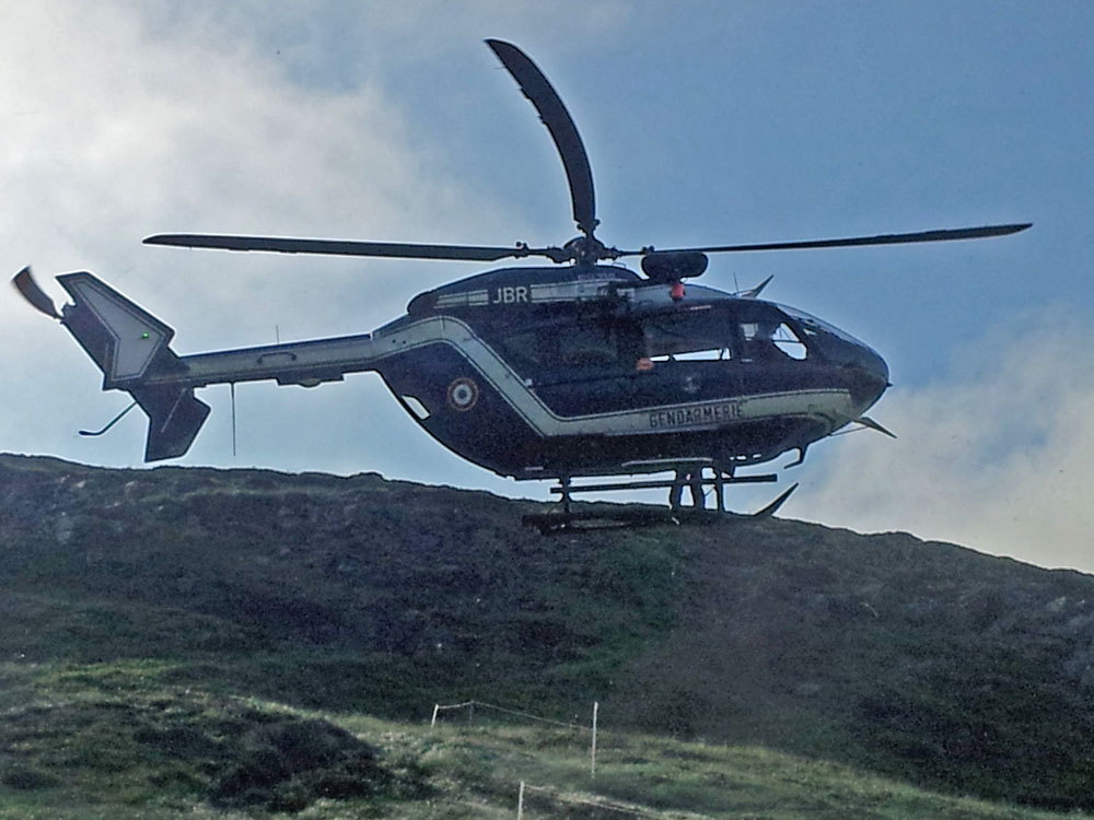
Later, out of the forest and above the clouds, we are back in the blue climbing a thirty percent slope in what seems like thirty degree heat. P is tiring, walking slowly, panting. We regroup at the dam. We are almost there and it is nearly flat here. Drawn by the prospect of a cold beer, we leave P behind. Nothing can go wrong now, we think. But two hours later he is being bundled into a helicopter.
When he didn’t arrive I went back to look for him. He was stumbling along, groggily, holding his arm.
“I fell over backwards,” he complains, showing me a tiny scratch. “I banged my elbow on a rock. Those lads picked me up.”
At the hostel, Anoura, the manager, asks me if it is serious. I shake my head but he scrutinises P who is rocking mechanically from side to side. “It looks like it is,” he says. He tests the arm’s mobility which doesn’t seem to be affected so P goes for a shower. But by the time he has finished his elbow is twice as thick as when he arrived.
“In any case he won’t be able to walk down with an arm like that,” says Anoura, picking up the phone. “If he trips he will do much more damage. We need to phone now. The crew will go off duty shortly and have to be called out specially.” It is not the first injury he has had to deal with.
Half an hour later the helicopter swoops in like a vulture, lands on a hummock, and whizzes our friend away.
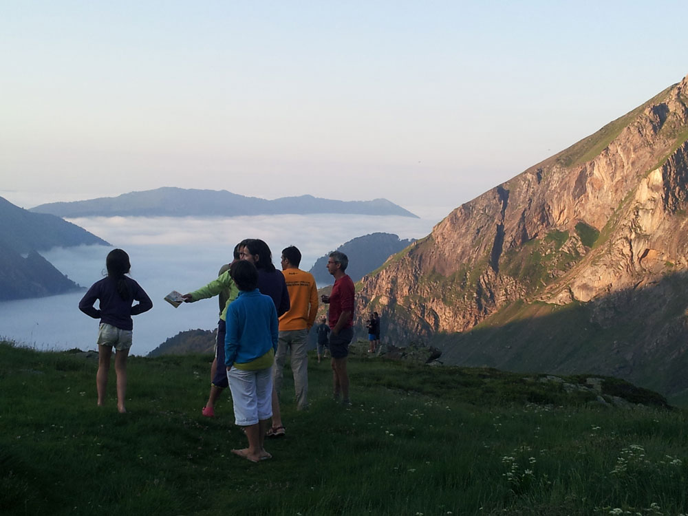
Sea of cloud in the valley below
A strange evening follows, thinking of how easily an accident can happen, talking “what ifs?” Mobile phones don’t work here. What would we have done if the hostel didn’t have a satellite phone? What would we have done without Anoura’s expertise?
The place where P fell wasn’t dangerous. He must just have been overtired.
Day two: the Pic de Crabère
In the morning the news is that P has a broken elbow and will be taken home before going to see a specialist. There’s nothing for us to do, so we climb Pic de Crabère as projected anyway. It reminds me of Canigou, a shoelace path on steep unforgiving rock. At the top the views are even more spectacular than those from Canigou. We identify the folds: Pic du Midi, Vignemale, Maladeta, Aneto, Pic d’Estats, Valier, Canigou – over half the Pyrenees visible at a turn of the head.
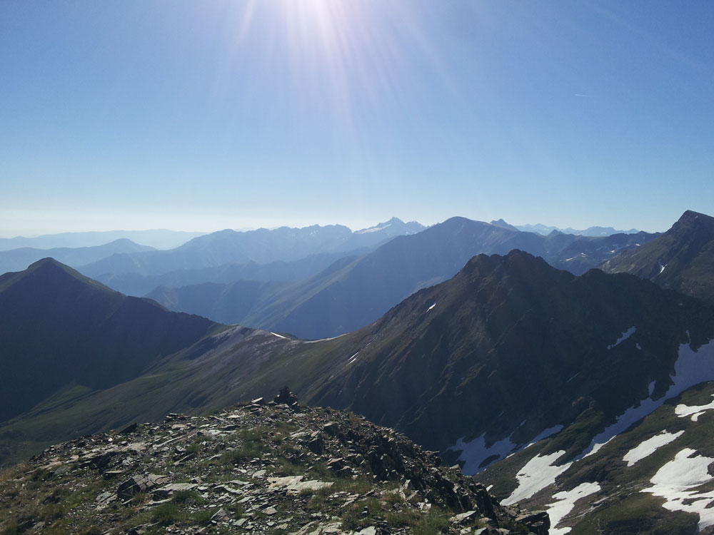
View from Pic de Crabère to the east, with the remains of snow on Canigou

Aneto (3404m, the highest peak in the Pyrenees) and Maladeta
Back down at the hostel a proud fisherman shows us his morning catch. Grabbing our lunch packs, we leave him to cook it on a portable barbeque.
The Pyrenean Way (GR10), our path home, climbs over a pass into the next valley. Down below, the cluster sheds repainted in rust have a romantic aura. The sheds, twisted rails and gawky pylons are all that remains of a dirty industrial hamlet, the Bentaillou mine, which closed over fifty years ago.
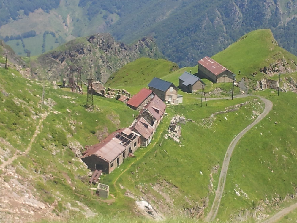
Bentaillou mine
The heat has been turned up again. Mindful of yesterday we stagger cautiously down, supporting ourselves on walking poles. There are bad days and good days in the mountains.


Footprints on the mountains