

Cet article est également disponible en: French
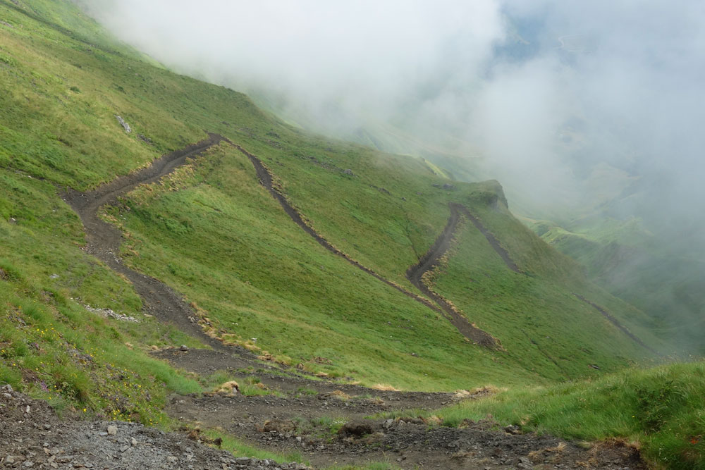
Diversion of the GR 10 west of Superbagnères
Coming back home for a rest from the exertions of the Pyrenean Haute Route (HRP), via a leg of the GR10, I got lost. Despite a big, clearly labelled arrow, I walked round in a circle. From the Col de la Coume de Bourg (2271m) to Superbagnères, instead of skirting along the hillside, the route now drops into the valley and then climbs out again on a freshly-made path.
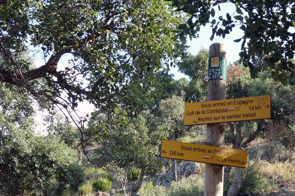
Diversion of the GR 10 east of Le Perthus
A rather older diversion further east is also worth noting. Immediately after passing under the motorway at Le Perthus the GR 10 now climbs back into the forest (passing absent-mindedly into Spain) before re-joining St-Martin-d’Albère. A great improvement: previously it followed the road for many kilometres.


Footprints on the mountains