

Cet article est également disponible en: French

Mill leat
I used to think that Puig Neulós was rather dull. Despite its 1256m summit it had always struck me as a rounded green pimple, overshadowed by big brother Canigou, more than twice as high. The climb from the plain is just a little too ordinary to be motivating. Worse still, when you get to the summit, you meet up with cars and a road.
But this year I have already climbed it twice. I have discovered not only its hidden depths, but also a hidden story. The depths are to be found in a snow-well. The story is to be found in several different places; it was only hidden because I hadn’t looked carefully enough. It recounts the love of Manel, a shepherd, for the mountain where his sheep grazed.
Manel was poor and illiterate but has bequeathed us a remarkable legacy.
| He vist la Torre d’en Manel, Dirien que toca el cel : La broma li sert de trona, i lo llucet de corona. |
I have seen the tower of Manel; they say it touches the sky. The mist serves as a throne and lightning as a crown |
Extract from the Swallow of Saint Martin – original Catalan version – French translation
Manel dictated these lines, part of an ode he composed to Puig Neulós, towards the end of his long life. And Manel’s legacy is not the only trace of the past on this circular walk: it takes in a mill, a prehistoric tomb, the snow-well, a frontier ridge with magnificent views of the Mediterranean, and a conveniently placed hostel.
Puig Neulós is best climbed in winter. Only 10km from the Mediterranean, there is rarely any snow. And despite a name meaning ‘cloudy’ it is frequently bathed in the Mediterranean sun. Which is why in summer it is just too hot.
The classic route starts in pretty Laroque des Albères and heads south up the valley. By February the mimosas will be in flower, by March the path will be strewn with white almond petals. There is an ancient mill is being restored just above the village and the first part of the path follows the former mill leat, still used for irrigation, tracing it back upstream.
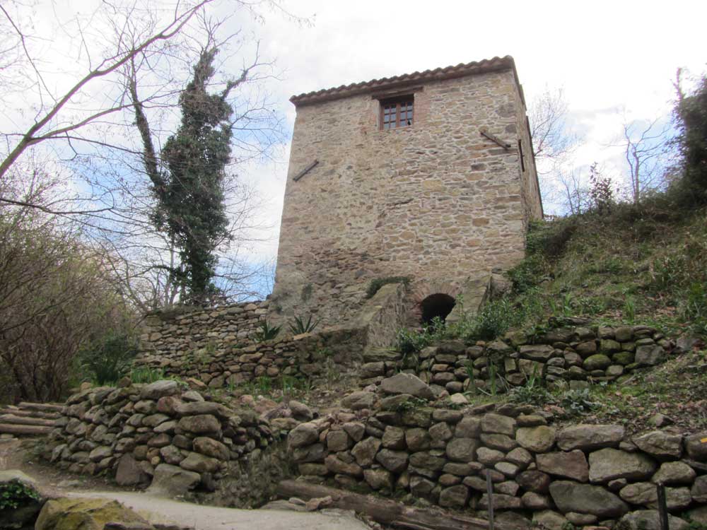
The Moulin de la Pave. At one time there were four mills on this tiny stream. The origins of this one go back to the fourteenth century.
At first, cork and holm oaks predominate, gradually repopulating the slopes after the devastation of the nineteenth-century charcoal burners. Soon, a short diversion leads to a clearing and a megalithic tomb: the Balma del Moro (Moor’s shelter). More recently the tomb has been re-appropriated: by a small stone painted with Hindu symbols labelled ‘Aum siva’.
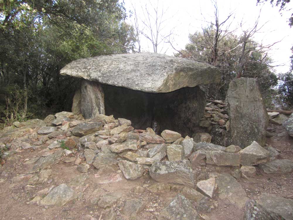
Balma del Moro

A recent addition to the tomb’s religious symbolism
The path continues up. When I was there in February, golden beech leaves still lay in deep drifts along the path, just right for kicking into the air, although the spring snowdrops were already flowering.

Manel’s tower near the summit of Puig Neulós
The summit itself is graced by a Manel’s (rebuilt) tower but disgraced by the television mast which knocked it off its plinth. The best thing to do is to look away, at the long crescent of Mediterranean sand to the north; at the rocky coastline straddling the frontier; at the Tour de Madeloc, a relic of the disputes between France and Spain; at Canigou, white from November to May.
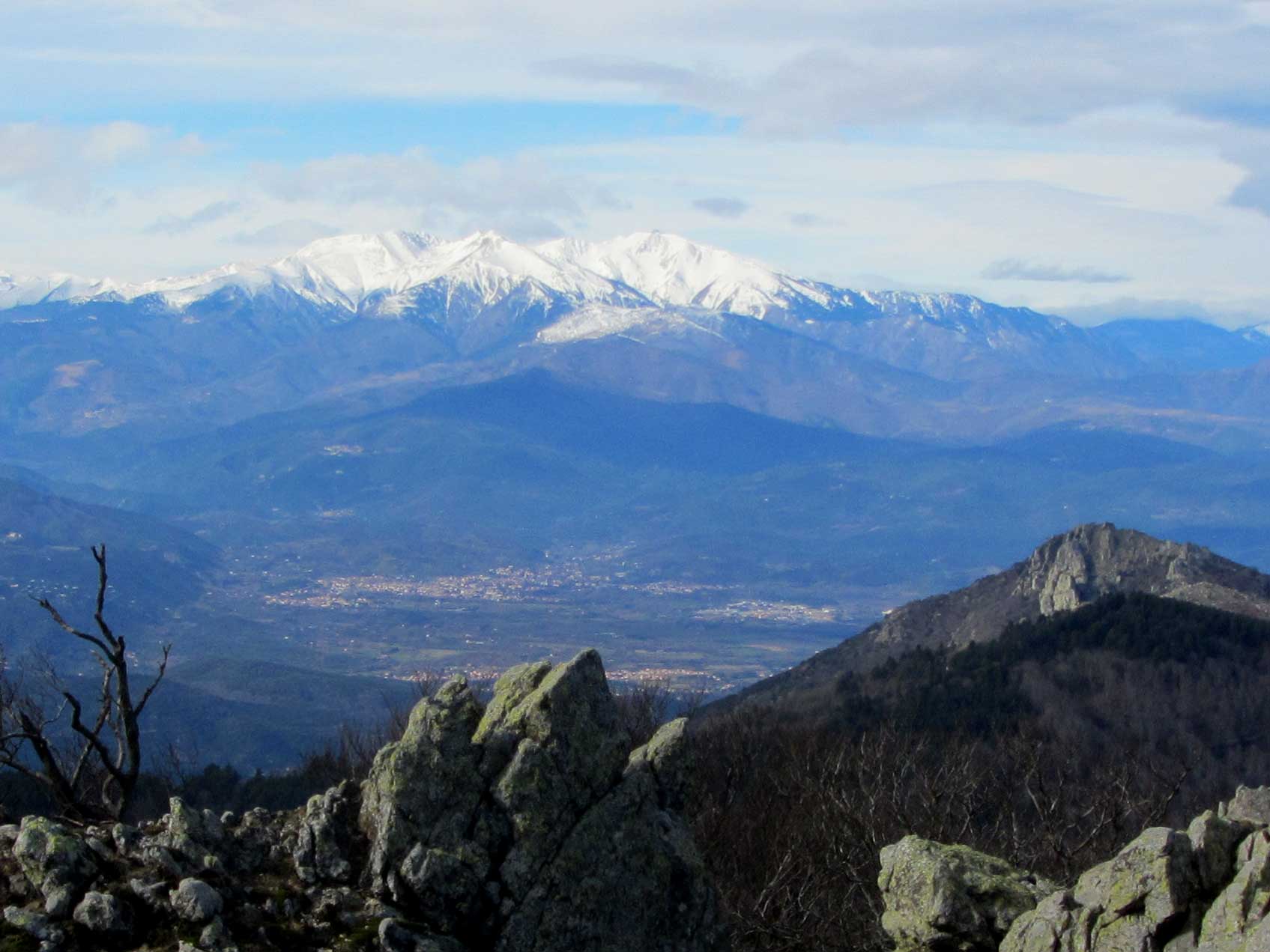
Canigou seen from Pic Neulós
What remains of Manel’s pastures are draped over the ridge, divided between France and Spain by a battered barbed-wire fence.
A kilometre further along and fifty metres down the slope into Spain I finally located the hidden depths of the mountain: a stone dome in the middle of the forest. A few metres away, what looks like a small stone hut is actually the entrance to a tunnel linking up with a circular chamber below the dome. It is rare to see snow below 1500m, which makes this pou de neu all the more mysterious. In Britain it would be called an ice-house; here it is a snow-well. The snow was shovelled in at the top in winter and extracted from the bottom in summer. It is a refrigerator, still in perfect working order after 400 years. (Beware, the TopoEspaña 3.0 map places the pou de neu some 70m away from its real location. The easiest way of finding it is to walk along the frontier fence to a gate with a fingerpost sign.)

Cross-section of the pou de neu
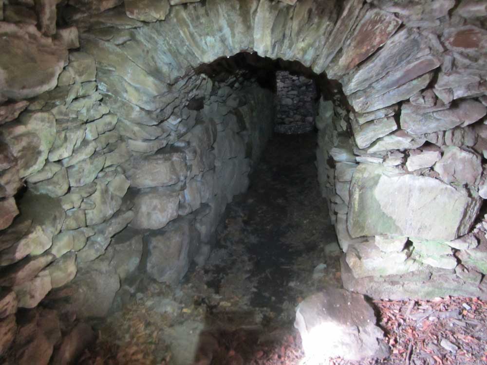
Inside the pou de neu (ice house)

Chalet des Albères hostel
Now following the red and white blazes of the GR10, the path descends through Black pines to the Chalet des Albères hostel (reservation-only in winter) and then back along a short stretch of road to an elaborately decorated spring. This is another of Manel’s creations.

La Reynes de las founs (Queen of springs)
Manel, the poet of the Albères
The Reynes de las founs (the Queen of springs) is dated 1881 and signed ‘M’. Sometimes Manel signed his work with a pictogram of Lac Leman, an anagram of his nickname, but as far as the authorities were concerned he was Joseph Pierre François Coste, born on Christmas day, 1822. He lived right through the 19th century to 1911.
The most telling part of the decoration is a heart made of chips of blue stone with a single red marble insert. The object of the love is given in the inscription: Forêt de Laroque.

For the love of a mountain
Another inscription reads enigmatically: les douaniers ici trouvent souvent ce qu’ils y cherchent – the Excise Men often find here what they were searching for.

Inscription at the spring near the Chalet des Albères
Manel was a poet without a pen. Preferring stone to paper, he asked friends to trace out the necessary letters on stones he had prepared. Then he chiselled his immortality. He didn’t just work in stone: the venerable sequoia a little higher in the forest was a seedling when he planted it. And there are many other examples of his oeuvre.
I think of Manel as the shepherd counterpart of the illustrious Henry Russell-Killough. They each loved their respective mountain, though a whole world separated them socially. For Count Russell-Killough, Vignemale was the chosen one. In the Gazette de Cauterets he wrote: ‘Vignemale is my wife and my seven caves are our children.’

On the Vignemale (3298m)

Statue of Henry Russell-Killough at Gavarnie
One of the pioneers of the Pyrenees, Russell’s story is well known. He leased Vignemale from the State for 99 years and paid workers to dig the caves. Manel, on the other hand, saw the State confiscate his domain, even temporarily forbidding him from maintaining the spring before relenting and awarding him the médaille d’or des vieux serviteurs (gold long service medal).
I don’t think they ever met – Russell disdained the Albères – but they were kindred spirits; both were honoured by obituary notices in the Bulletin du Club Alpin Français.
***
The way back down to Laroque passes through a chestnut wood before re-joining the mill leat. There is a second more ruinous snow-well to visit on the way.
In all about seven hours walking with some 1200m of climbing, a single day to discover the history of the Albères. Walking in the Pyrenees in winter doesn’t come much better – at least not without snowshoes.
***
The route is available on Wikiloc


Footprints on the mountains