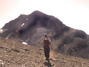
 August 2009. The name means the “lost mountain” and Mont Perdu – Monte Perdido in Spanish – is about as far as you can get from a road in the Pyrenees. Some early geographers thought it was the highest in the range and it took the pioneering Ramond several attempts to get to the summit. Even though it has now been relegated to third in the height tables, it is still a challenge. We could have taken the Spanish route – a 4-hour slog, climbing up the 1200m from the Goriz refuge in the babbling company of dozens of other walkers on a well-worn path. But we wanted to experience nature in silence, and walk along the empty moonscape ridge of the Cirque de Gavarnie. And we wanted a challenge.
So we chose the classic itinerary from France, a route pioneered by Henry Russell. It is more “technical” than the Spanish path: passing from one ledge to another involves some minor rock climbing and we are ramblers, not climbers. But, according to my guide book, the path is suitable for très bon randonneurs (very good walkers).
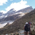
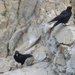
Evolène, Claude and I stay overnight at the Refuge des Sarradets. Near the hostel, an ermine darts from one rocky hiding place to another leaving footprints in the snow. The yellow-beaked chocards keep their distance but the niverolles come to beg for crumbs like domesticated sparrows.
Despite the nearby animation, the focus of our attention is further away: below us, the splendid natural amphitheatre of the Cirque de Gavarnie with its dramatic waterfall; above us, the long curving cliff marking the frontier ridge with Spain, its height emphasised by the Brèche de Roland, a 100m-high, 40m-wide missing tooth. The name derives from an epic poem: on the return journey from Spain, the dying Roland, “his brain coming out of his ears”, broke his sword Durandel against a rock.
Next day, in the half-light, we scramble up the scree and frozen snow to the Brèche. Climbing through the missing tooth, we see inside the jaw, a mirror image, another long cliff stretching in both directions.
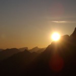
The sun rises over the Cirque de Gavarnie behind us, washing the heights with blood and gold as three stout men overtake us. “This is the fifth time I have done it, but I got lost twice, missing the way up the cliff,” explains the oldest of them. “Follow us and you will be alright,” he claims. But they race ahead, quickly outdistancing us.
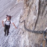
Now in Spain, insouciant of formalities, we turn east keeping just under the cliffs. At first, a chain is provided on the traverse across the plunging hillside. Next, at the Col des Isards we have to scramble up billowing white rocks. Then, the first snow-field appears and we put on our crampons. Finally, the path disappears into a sea of rubble. At each cairn we stop, straining to
distinguish the next one. We are stealing gradually but disconcertingly up towards the base of a near-vertical cliff face. We can see a jumble of cairns leading up the face so we head for one of them, hauling ourselves up with our hands. My insouciance is wavering.
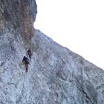
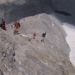
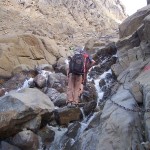
“We might get up but I’m not sure how we will get down again,” I call to Evolène who has already climbed up. “Try going round,” she says. “It doesn’t seem that difficult to me but you are making me wonder if I should be more afraid.” Fear is catching and Claude has already picked up the virus: “I’m not sure either,” she wavers. But we find a way round, though it still needs hands. The climb – it is not a path, just discoloured rock punctuated by miniscule cairns to indicate the way – zigzags up the 20m to finish on a reassuring 1m-wide balcony. Finally, at the end of the balcony, we emerge into open space, safety and exhilaration.
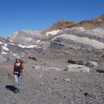
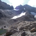
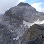
Here on the frontier ridge between France and Spain, all is mineral; white, grey, black, ochre. Solid, unforgiving. Raw dislocated strata projecting at all angles, no lazy “beds” of rock. Down below us to the south, in contrast, the landscape is dreamy. The air is thin, the colours washed-out, soft. Claude points out the Pico del Descargador, a mound of white rock bands alternating with yellowing grass. “It looks like a giant stack of pancakes,” she says. Further away, deep canyons slice through the dusty layer cake.
Several snow-fields later and we reach the lip of the Cirque de Gavarnie at the Col de la Cascade and look down into France, into a cauldron of simmering cloud. The top of the famous waterfall, 700m below us, is only just visible. The cairns continue, keeping roughly level until another easy scramble brings us onto l’Épaule and the start of a lazy walk to the Étang Glacé.
The Etang Glacé feeds on the meltwaters of Month Perdu and then pours them into the rock at its lip. They emerge 2km away at the head of the 423m high Gavarnie waterfall. The path from Goriz passes to one side of the lake, and scores of other walkers are distributed along the ridge which leads up to the summit – scrambling up 100m of smooth rock, followed by a tiring 300m of loose scree.
At the summit, a brief panorama awaits us, the iridescent Lac du Marboré, the Pic du Midi with its telescopes, the Vignemale and its glacier, innumerable other summits. And then the clouds billow in from Spain abruptly severing us from the world. Only the neighbouring Swiss-roll Cylindre du Marboré remains visible.
Ramond, writing in 1789, gave Mont Perdu a height of 1763 toises (3436m): “Even if you have been to Mont Blanc you must come to Mont Perdu: when you have seen the highest granitic mountain, you should see the highest calcareous one.” But his interest was more scientific than aesthetic. How could calcareous deposits with fossils of sea creatures be so high? Were calcareous deposits always higher than granitic ones? Were they therefore younger? Ramond became known as the “inventor of the Pyrenees” – he brought them to public (ie Parisian) notice – and Mont Perdu and the surrounding mountains were his most famous inventions.
“Perhaps we should go down to the refuge at Goriz.” I suggest. “My GPS didn’t work because we were too near to the cliffs and we’ll have difficulty finding our way back in the fog.” But the cloud separates briefly so we rush off while we can still see what we are doing. In Spain the clouds are churning and we hear thunder way below us to the south, but France and the frontier bask under clear skies.
On the way back we look down at Gavarnie and the Cirque again. Now that the low mist in France has evaporated, the valley looks pastoral and beguilingly peaceful. But under the surface, all is not well. The early days of geology, the youth of mountaineering, and the flowering of the French Romantic movement were all written here. For this, and for the stunning contrast between the bucolic valley and its ragged heights, the area was designated a World Heritage site in 1997. Now it is under threat. An annual festival uses the Cirque as its backdrop: World Heritage status may be withdrawn.
Back at the hostel, we sit on the steps in front of the entrance, talking about the day. “Normally it is the summit which counts,” I say, “but today it was right at the start, the moment when we stepped out onto the plateau at the end of the balcony.”
Postscript
The next day it is suffocatingly hot in Gavarnie. I’ve been to the waterfall before but Evolène and Claude have only seen it in photos. An easy walk to work up an appetite for lunch, as I remember it. The other tourists, we finally notice when it is too late, are wearing hats, each carrying a rucksack, stopping from time to time to sip on a bottle of water, nibble on a cereal bar, and slather exposed parts with sun cream. We have no water, no hats, no food, no sun cream. By the time we get back three hours later we are flaking, sweat cascading off our shoulders. Inconscient is the French term. It means stupidly ill-prepared.
Details of the walk Col des Tentes – Brèche de Roland – Mont Perdu
We did the walk in early August 2009. From the car park at the Col des Tentes (2208m above sea level) above Gavarnie, it took us 1h45 to get to the refuge des Saradets (2589m). The next day we walked for 10h30, to Mont Perdu (3355m) via the Brèche de Roland (2807m) and back to the refuge (rest breaks added 1h30, making 12 hours in all). Then 1h30 from the refuge to the car park on the third day. Crampons and an ice axe were essential to avoid detours, especially in the morning when the snow was still frozen.
There are several routes between the refuge and Mont Perdu. We took the high-level route, as recommended by the hostel manager, following cairns. All routes include some “easy” rock climbing (2 on the French scale) but the main problem is navigation. When we were close to the cliffs (just after the Brèche de Roland) my GPS didn’t work and the landscape is so convoluted that even large scale maps are difficult to read. Even though we had prefect conditions for the return journey we had to backtrack twice before finding the correct route. In addition, although there is only 600m of climbing, most of the day is spent at around 3000m, and even ordinary walking quickly eats up energy.
By the way, you need to like rocks. There is virtually no grass and no trees.
Accommodation: Refuge des Sarradets (also known as the refuge de la Brèche de Roland): evening meal, bed in a dormitory, breakfast, and packed lunch 42 euros. Advice on the route comes free. Fill up water bottles in the evening as the water pipe from the mountain spring freezes in the night.
A slightly different route can be found here and another one here
References
Comparing Mont Blanc and Mont Pedu: L. Ramond de Carbonnières. Voyages au Mont-Perdu et dans la partie adjacente des Hautes-Pyrénées, p. 115.
Henry Russell, Souvenirs d’un Montagnard, éditions Pyrémonde.
Thanks to Evolène and Claude for the photos.








Footprints on the mountains