

Walking in the Pyrenees
Cet article est également disponible en: French

The GR10 crosses the Way of Saint James in Saint-Jean-Pied-de-Port
If you are looking for a walking guide to the GR10 trail in the French Pyrenees, I recommend the FFRP series. Even if you struggle with French, the terms are repeated so often that you’ll soon learn them. More importantly, the guides have 1:50,000 scale IGN maps, and profiles and times for each day. On the other hand, if you want to get a feel for the GR10 before committing yourself, or if you want to discover the Pyrenees from the comfort of your armchair, then If you only walk long enough: exploring the Pyrenees will be of interest. Let’s be clear, it is not a guide book to the GR10 walk. It is my personal experience of trekking from Hendaye to Banyuls. It took me 63 days.
“Changing valleys once or even twice a day, the GR10 snakes up minor passes but shuns the highest peaks of the range, passing through countryside which is sometimes rugged, sometimes bucolic, but rarely banal. At the end of the day it makes a detour to sniff out a meal and a bed.” — Steve Cracknell
Second edition of If you only walk long enough: exploring the Pyrenees
A updated edition was published in 2016, now with 30 photos. This edition is avaliable at Amazon, in print and on the Kindle. It is also available as an e-book.
Les Pyrénées tout en marchant sur le GR10
There is also a French edition published by Éditions Cairn.
Walking in the Spanish Pyrenees
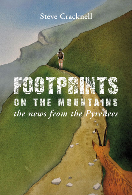
Footprints on the mountains… the news from the Pyrenees
And for those who are considering the Spanish alternative, the Senda Pirenaica trek (GR11) my book Footprints on the mountains was published in 2016.


Hello Steve, I have been invited to walk from Bayonne towards St Jean Pied de Port with 2 friends in early June. We do not have any experience of long distance walking but are reasonably fit. I plan to meet up with my husband & campervan each evening though they would camp. Do you think it is too ambitious and a good time of the year to start? Thanks, Judy
Hi Judy
Sounds just right, especially the husband to pamper you.
Have fun, Dteve
Hi Steve!
I’ll be starting the GR10 from Hendaye mid June. We plan to camp most nights and I’m trying to decide on a sleeping bag and/or liner. I haven’t found many resources on what temperatures to expect during the day/ night. What would you expect are the average and lowest temperatures we should prepare for?
Thank you!
Kate
Hi Kate
Thanks for asking this. I’ve realised that the info was missing, but I have now put it on my Guide to walking the GR10 page.
Steve
Dear Steve
The website/blog is invaluable; very many thanks for being so generous in sharing your experiences, advice and insights.
I am in the early stages of planning an Hendaye-Banyuls walk for summer 2019 – so some way off! I am currently looking into the very wide range of GPS navigators – I have noted the one you use – and am rather overwhelmed by the choice. The Garmin range is clearly impressive – though the more expensive ones seem not to permit the downloading of maps; the cheaper ones don’t offer texting etc – so, less communication with the outside world; others have less battery time, while others – Garmin and other makes – seem to go wrong after a year or so, according to some customer comments posted on Amazon.
It would be very helpful – if you are able – to hear your views on those that are on offer.
Many thanks
Mark
Hi Mark
I only have experience of the Garmin range (since about 2002). The three I have had have stood the test of time, being upgraded for new features. I’ve just been investigating one to be shared by members of my walking club and we are going to buy an Etrex 35 Touch. As far as I know all Garmins allow downloading maps. The 35t Touch comes with pre-loaded maps; perhaps that is what you are thinking of.
In any case don’t buy a map of the Pyrenees. OpenStreet maps for much of the world can be downloaded for free. But better than that, for the Pyrenees you have TopoPireneos, which has better graphics than OpenStreet Map (follow the instructions carefully).
Alternatively just use your smartphone and Wikiloc off-grid maps. The great advantage of this is that the screen is bigger.
The main issue for both the GPS and smartphones is battery life. The 2 AA rechargeable batteries for the Garmin GPS last about 16 hours, so I normally carry 6 plus a charger because you can’t always find a socket to charge from in refuges. Unfortunately, my smartphone battery only lasts about 6 hours even in airplane mode. So I have now bought a battery pack 10,000mA which gives about 6 recharges, but weighs 200g.
Happy planning.
Dear Steve
That’s terrific; very many thanks. The Garmin that it seems does not permit the downloading of maps – according to some consumer comments – is the inReach Explorer; perhaps you have come across this one?
Many thanks
Mark
Dear Steve,
Your website is wonderfully informative. Thank you. I am part of an international summercamp and planning to walk with a group of adolescents for apprximately 10 days, accompanied by a group of adults (experienced hikers). I am thinking of what route to take, and your website inspired me to go for the GR10; thinking of the section StJean de Pied – to – Gabas. As we will be hiking in the mid-summer (second half of July) my main worry is the climate. will it potentially be too hot? Will there be too much rain and mist (or so I have heard)?
Thank you in advance.
Mark
Hi Mark
I guess you are working on this with Michiel Blumenthal. Yes SJPP to Gabas is a suitable section. Walking in the mountains is always hot work on the uphills. But don’t worry, on that section you will be high enough – and as I said to Michiel if you set out early you will avoid most of the heat. Also, the main rain and mist is between Hendaye and SJPP. So again no problem. Have fun.
Hi Steve,
I am sorry, some thing went wrong (and sentences mixed up..) please Re-read my write up.
I am from Australia, planned to walk High route Pyrenees (hendaye- to Banyuls-sur-Mer). I start walking 5th August 2019 from West to East. I came to know there are Bears in Pyrenees.
As I am solo hiker for safety I would like to carry with me Bears Spray Deterrent and loud noise making equipment in case if I be confronted with Bear(s).
Please advice where in France I can buy them.
Regards,
Mohammad
Hi Mohammad
Nobody here uses bear spray and making loud noises is not considered a good idea. As far as I know you cannot buy bear spray. The chances of you seeing a bear are extremely low. So do not worry. It is much more important on the HRP to know how to navigate
Hi Steve
For a week long hike in September, staying in hostels each night where would you recommend? Please not the Camino.
Any help gratefully received 🙂
Susan
Hello Susan
Guessing that you don’t know the Pyrenees, I would recommend Hendaye to St-Jean-Pied-de-Port. Green, and not too much climbing compared with the other end of the mountains. Alternaively Mérens-les-Vals to the Ras de la Carança on the GR10 and then down to Thuès-entre-Vals through the gorge de la Canança. This is more challenging, but wilder. All the end points are on train lines.
Happy planning
Steve
Hi Steve!
I am looking for information about GR10 and found your blog. Thanks for the detailed instructions, I found a lot of useful things for me. I would also like to ask: I plan to go part of GR10 in May 2020. I am 60 years old, I went several Camino in Spain, there were some mountain climbs, but not very steep. Two years ago I walked through the mountainous Negev desert in Israel, there were steep climbs.
Now I want to test myself in trekking on gr10. I have about 30 days and would like to spend them in the Pyrenees. I´m planing to start from Lourdes and go to the Atlantic. First of all, I want to go through the Luz-Saint-Sauveur – Cauterets section. Next, I want to continue the way on gr10 further to the ocean. I’m in good shape, but I want to go alone. Am I very arrogant?
With regards,
Galina
Hello Galina
No, you are not arrogant but you almost certainly cannot walk the GR10 from Luz-St-Sauveur heading west starting in May without either crampons or snowshoes (or a lot of snow experience). If you really must go in May, start in Hendaye. See my page on snow reports for walkers in the Pyrenees. But you would be better to postpone your walk until June.
I would suggest, whatever you decide to do a shakedown walk of a minimum of 3 days/2 nights with all that you intend to take. The amount of climbing you do is more important than the distance. You must include 700m of climbing and 700m of descent each day, even if it means climbing the same mountain two or three times to get that much climbing in. I also recommend reading sites about ultra-light hiking, but don’t compromise on safety in reducing weight.
Please feel free to ask more questions.
Have fun planning your trip.
Best wishes, Steve
Hello Steve, thanks so much for your quick reply! The more I read about gr10 (including your blog), the more I understand that May is really the wrong time for my travel. Then my daughter gets married in June, so I should go in July. I think I’d rather go in the heat than on snow and ice.
Then, in my opinion, trekking and mountaineering are still different things. Do I have to climb like a mountaineer? For this I am not ready. ((
I really want to go with an ultra-light backpack, so I ask: will I find an overnight stay on this segment for every night? Or at least countrysides, so that I can buy food every day, and not carry with me the food for several days.
Now I will study the information on the links that you showed, and I will come back with questions again. Thank you for your generosity in respect of tips!
Galina
I also think that September and early October will be a more appropriate time, is it right? I have an opportunity to go at any time.
Hi Galina
Starting at the beginning of September would be fine, but the hostels close at the end of September so October would only be OK if you want to camp.
Happy planning, Steve